Cronulla Sand Dunes
on Gweagal Country
Environmental Change and Management
Sandunes and Coastal Management
Discover Environmental Change and Management in a coastal environment at the Cronulla sand dunes. Enjoy an immersive field trip that brings the stage 5 geography curriculum to life!
Students will use field equipment to investigate biophysical process that influence coastal erosion and deposition, collecting primary data that will contribute to a broader understanding of how coastlines change over time.
Students will also have the opportunity to investigate secondary sources in the field, visualising how Wanda Beach and Elouera Beach have changed with human development, and how this has been managed.
Auseco also offers two other programs that also run in Cronulla:
- Stage 4 Landscapes & Landforms and
- Stage 6 Earth’s Natural Systems.
For more information, please contact the Auseco team.
Explore Sydney’s Cronulla sand dunes – A field study for Secondary Geography Students
Curriculum aligned, expertly guided excursions for Stage 5 Geography in Greater Sydney
Cronulla Sand Dunes Excursion Meeting Point
Curriculum
NESA aligned, curriculum-linked syllabus outcomes and suitable for all high schools including NSW department of Education Schools.
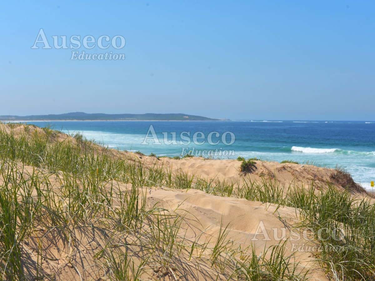
Experience hands-on outdoor environmental education at Cronulla, aligned with the NSW stage 5 geography syllabus. Engage your students with real world learning at some of the best active sand dunes in the greater Sydney region. This natural landscape is constantly shifting, allowing students to witness deposition and erosion before their very eyes!
Content:
Stage 5 (Year 9–10): Environmental Change and Management
- Examine how coastal environments function naturally, and how human development may alter these processes.
- Investigate the causes and consequences of changes to coastal environments
- Compare coastal management strategies at various coastal environments and evaluate the effectiveness of strategies in a human and environmental context.

Wanda Beach Meeting Point
Wanda and Eloura Beaches, Cronulla
Located 30km from Sydney’s CBD, it can take up to 1 hour 15 minutes in peak traffic).
We can start as early as 9:00 am - and run up until 2.30 pm.
Auseco can accommodate schools who arrive by public transport at Cronulla train station.
Cronulla is a prime case study to engage your students when teaching Environmental Change and Management.
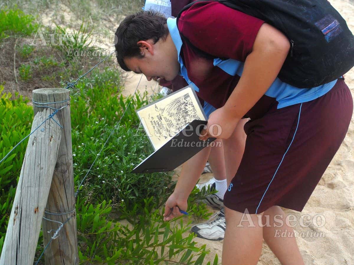
This site showcases coastal processes including wind and water-based processes, with deposition and erosion occurring before students very eyes! It is also the perfect site to investigate biodiversity through coastal vegetation identification and participate in dune profiling.
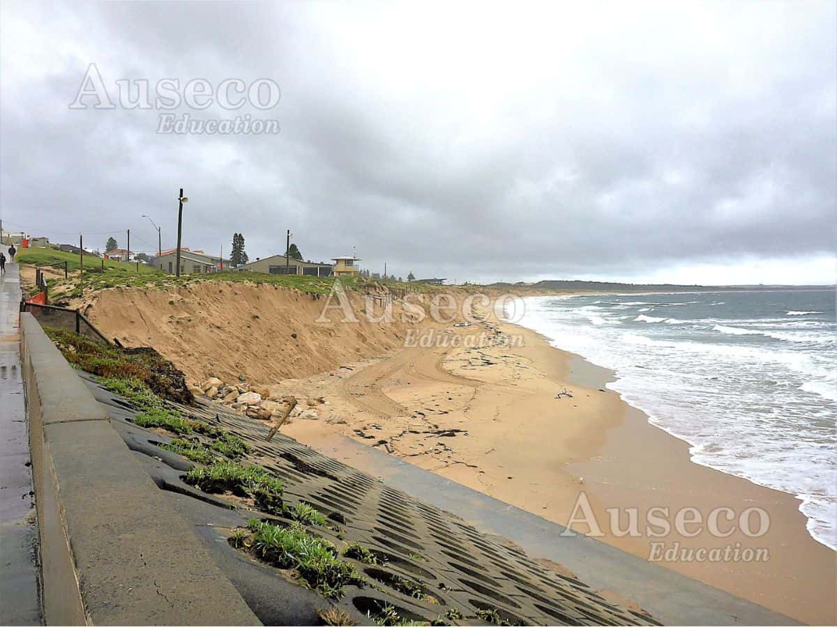
There has historically been a lot of development along the Cronulla coastline, which has resulted in various coastal management strategies being used both historically and in current day. In recent years the Greenhills and Shearwater developments have offered further examples of human development on sand dune systems. The site is perfect for showing students the how coastal development can change the coastlines!
Environmental Change and Management – Cronulla
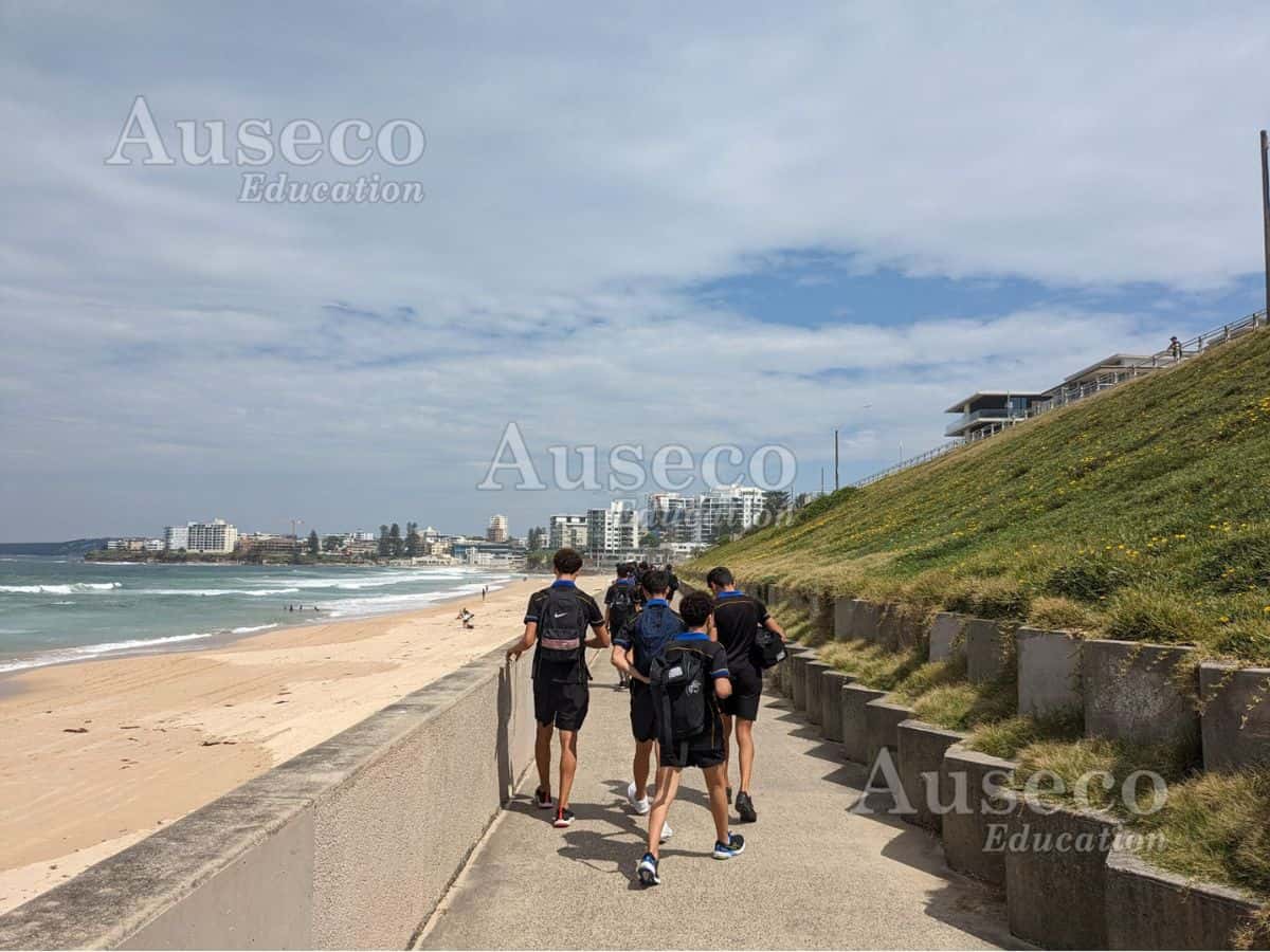
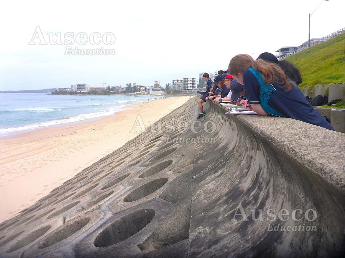
Renowned amongst surfers for their superb swells, the beaches of Cronulla have some of the best active sand dunes in the Sydney region. Our starting location, Wanda beach, contains large sand dunes that display the biophysical processes that form and maintain sand dunes. We will also visit Elouera Beach, which displays a wide variety of coastal management strategies visible even from the footpath!
Syllabus outcomes from this field trip
- GE5-2 explains processes and influences that form and transform places and environments
- GE5-3 analyses the effect of interactions and connections between people, places and environments
- GE5-4 accounts for perspectives of people and organisations on a range of geographical issues
- GE5-5 assesses management strategies for places and environments for their sustainability
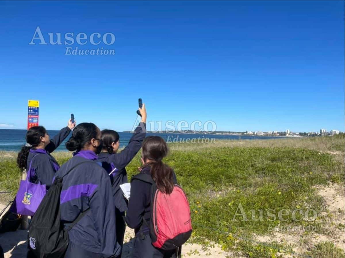
- GE5-7 acquires and processes geographical information by selecting and using appropriate and relevant geographical tools for inquiry
- GE5-8 communicates geographical information to a range of audiences using a variety of strategies
Whats included in the Excursion?
Expert field guides
Led by qualified educators with science and geography, and teaching backgrounds.
Curriculum Workbooks
Stage-appropriate student worksheets to guide and inform students through each activity and assist teachers with developing an assessment task linked to the field trip.
Hands-On Field Testing
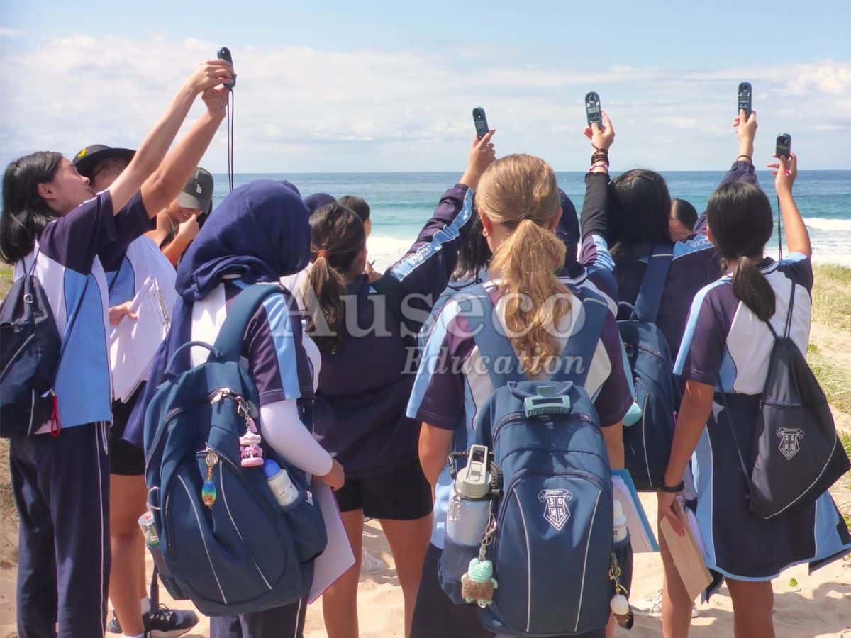
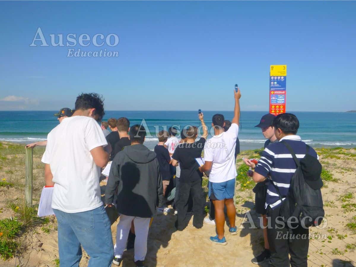
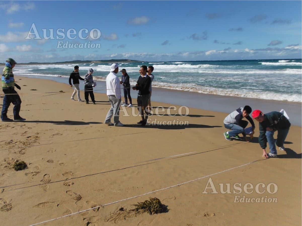
Investigate the function and management of a sand dune system through hands on field testing: Create a dune profile, measure wind speed and identify coastal vegetation.
Supported by Secondary Sources
Use a map and oblique photographs to identify and locate coastal landforms. Explore historical photos and historical aerial photos to examine changes overtime and compare these to the coast’s current development and management strategies.
Post-Excursion Resources
Answer sheets to assess the worksheets in the classroom, supplementary reading material, and photos of your day.
Fully Assessed Risk Documentation
All safety protocols and documentation are provided in advance.
Students work in small groups, so every student gets an opportunity to have a go! They will use tools and equipment not readily available at school to collect and interpret real-world data.
Transport & Accessibility
- Bus Access: Parking available for school buses.
- Public Transport: Nearest train station with a short 25 minute walk.
- Accessibility: Walking tracks suitable for all fitness levels and beach wheelchairs. Beach wheelchairs can be hired from local council and must be organised by the school ahead of time.
Sand Dunes
Sydney’s scenic coastal suburbs, and their associated challenges for seaside development, are the focus of this geographical investigation. We’ll collect primary data to observe some of the processes that form and alter natural sand dunes, constructing dune profiles, vegetation profiles, and wind speed tables, and we’ll study the changes in the coastline over time using historical data. A tour of the coastline accompanied by secondary data (historical photos) allows students to compare current and past management strategies and developments and evaluate their effectiveness.
Locations
- Long Reef and Collaroy coast
- Cronulla
Program outline
- Morning session: Site briefing, map work, dune profile, vegetation profile, wind speed tests
- Midday session: Historical photos, coastal traverse
- Afternoon session: Coastal erosion management strategies in action, including up close observations of a seabee wall
Activities are performed in a rotation to accommodate multiple classes. The timing and location of activities will vary according to factors such as the school’s schedule, number of classes, and the environmental conditions on the day.
Sample worksheets are available which also contain details of geographical skills, equipment and secondary data provided by this program. Contact us to request.
What Students will Learn
- Investigate the biophysical processes essential to the functioning of Wanda and Elouera beaches
- Identify the causes, extent and consequences of human-induced environmental change across Wanda and Elouera beaches
- Observe and discuss management of environmental change, including the factors that influence management responses and the effectiveness of these practices.
Testimonials
The Auseco difference
Locations right across Sydney
We operate at a range of Sydney’s most scenic locations
Dedicated equipment & secondary data
We provide all the field equipment and secondary data for your day
Teacher’s pack with risk assessments
Comprehensive details are provided on what to expect for your excursion.
Experienced & engaging staff
Our expert guides come from a diverse range of backgrounds