Excursion locations
Field studies in Sydney’s most scenic places
At Auseco we pride ourselves on our variety of field study sites across Sydney.
Our excursion locations have been hand-picked to provide the best field study experiences for your students. They are spread across Greater Sydney, within reach of schools in the Illawarra, Southern Highlands, Canberra, Blue Mountains, Central Coast and Newcastle as well as Sydney itself.
Select from a location on the map or choose from the list below.
Have a location you would love to have a field study run at? Contact us
Bantry Bay
Bushland, scenic views and freshwater creeks in Sydney’s north
Barangaroo
World-class sustainable business district in the heart of the city
Bass Point
Rock platform and aquatic reserve near Shellharbour in the Illawarra
Botany Bay
Mangrove and seagrass wetlands near Towra Point Nature Reserve
Cabramatta
Vibrant suburb with Asian cultural influences in Western Sydney
Camp Coutts
Freshwater creeks in a secluded bushland valley south of Sydney
Camp Kedron
Hidden valley on the edge of Ku-ring-gai Chase NP in Sydney’s north
Cronulla
Spectacular sand dunes and beaches in south-eastern Sydney
Dairy Creek
Suburban stream flowing through bushland Oatley Park on the Georges River
Fisherman's Beach
Protected beach, rock platform and headland on Sydney’s Northern Beaches
Long Reef and Collaroy Coast
Scenic sand dunes and headland among Northern Beaches coastal development
Long Reef rock platform
Aquatic reserve and Northern Sydney’s largest rock platform
Manly Dam
Freshwater reservoir and nature reserve tucked away in Sydney’s north
Millers Point to Milsons Point
Superb views and colourful waterfront suburbs linked by the Harbour Bridge
Mt Keira
Magnificent rainforest beneath the Illawarra Escarpment near Wollongong
Narrabeen rock platform
Easy-to-access rock platform, beach and headland on the Northern Beaches
Pyrmont
Modern high-rise suburb with historical roots in Sydney’s Inner West
Ultimo & Chippendale
Bustling university suburbs with an industrial past in the centre of Sydney
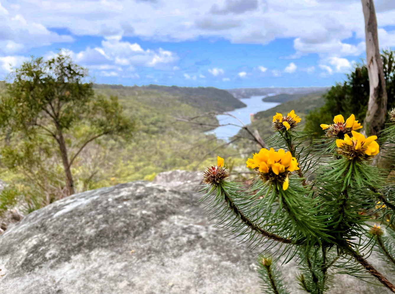
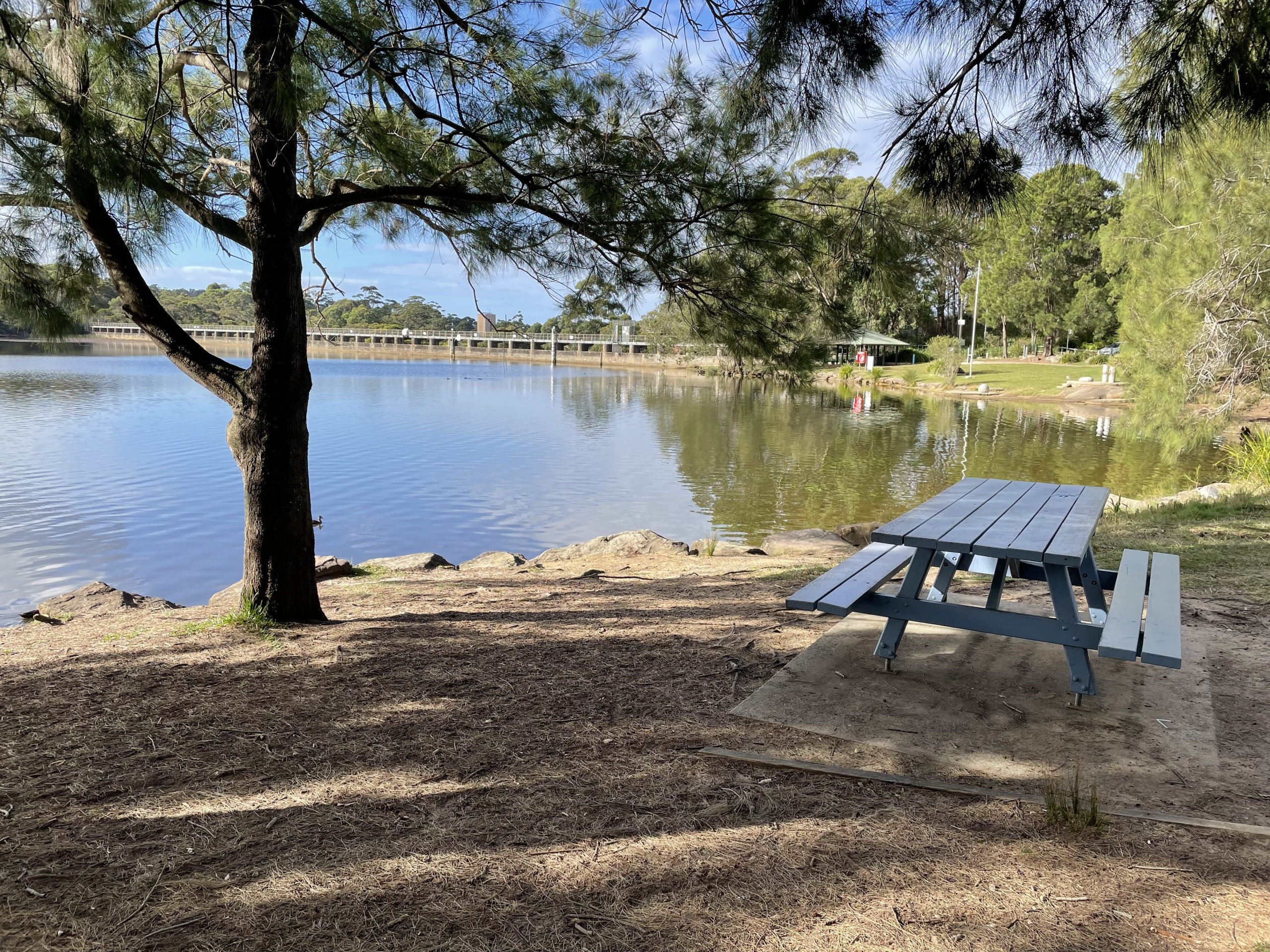
Bushland, freshwater and forest sites
Bantry Bay (Frenchs Forest)
Camp Kedron (Ingleside)
Camp Coutts (Waterfall)
Dairy Creek (Mortdale)
Manly Dam (Allambie)
Mt Keira (Wollongong)
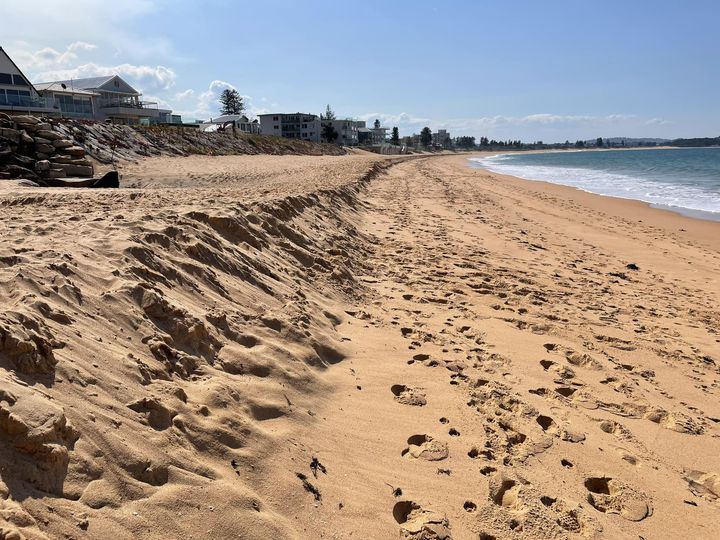
Marine and coastal sites
Bass Point (Shellharbour)
Botany Bay (Kurnell)
Cronulla
Fisherman’s Beach (Collaroy)
Long Reef and Collaroy coast
Long Reef rock platform (Collaroy)
Narrabeen rock platform
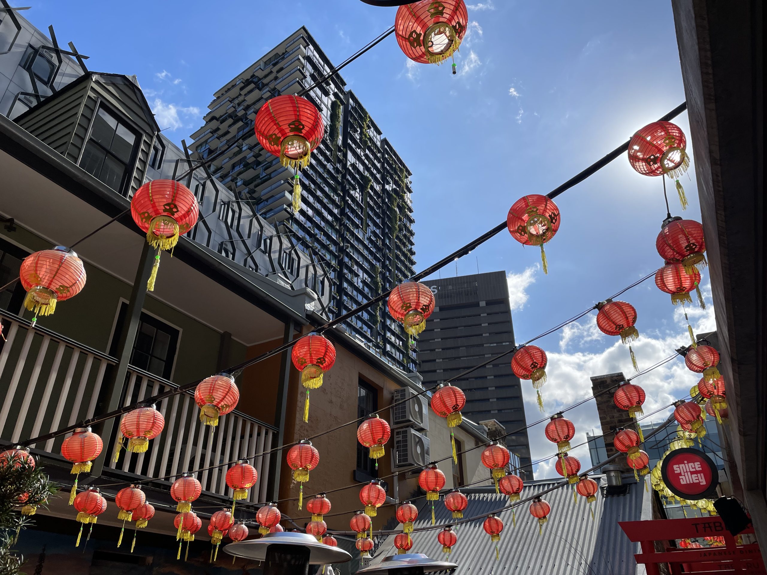
Urban and town sites
Barangaroo
Cabramatta
Darling Harbour (coming soon!)
Millers Point to Milsons Point
Pyrmont
Ultimo & Chippendale
Windsor (coming soon!)
Bantry Bay meeting point

Bantry Bay
on Garigal Country
The Hawkesbury Sandstone geology at this site not only influences the growing conditions for plant communities in the gullies and ridges, but its cliffs and crags provide unforgettable views across Bantry Bay and the city skyline. The bushland comes alive with wildflowers in winter and spring, and local creeks show evidence of human impacts from nearby suburban areas.
Excursions at this site
Landscapes & Landforms
Environmental Change & Management
Earth’s Natural Systems
Human-Environment Interactions
Ecosystems & Global Biodiversity
Living World (Stage 4 and Stage 5)
Biology (Modules 3&4 and Independent Research)
Earth & Environmental Science (Modules 1&4)
International Baccalaureate (ESS and Biology)
Meeting point
Ararat Reserve, Grattan Crescent, Frenchs Forest 2086
Please check your excursion pack for drop off and pick up directions. If you are having difficulty finding the site, or are significantly delayed, please call the team on 9970 6546 or 0432 549 205.
Risk assessment and site information
Teachers will be provided with a comprehensive Risk Assessment in the Teacher’s Pack prior to the field trip. This contains site information including details of the terrain, accessibility and facilities available. Please contact us with a request if you would like to receive your Risk Assessment earlier.
Barangaroo meeting point
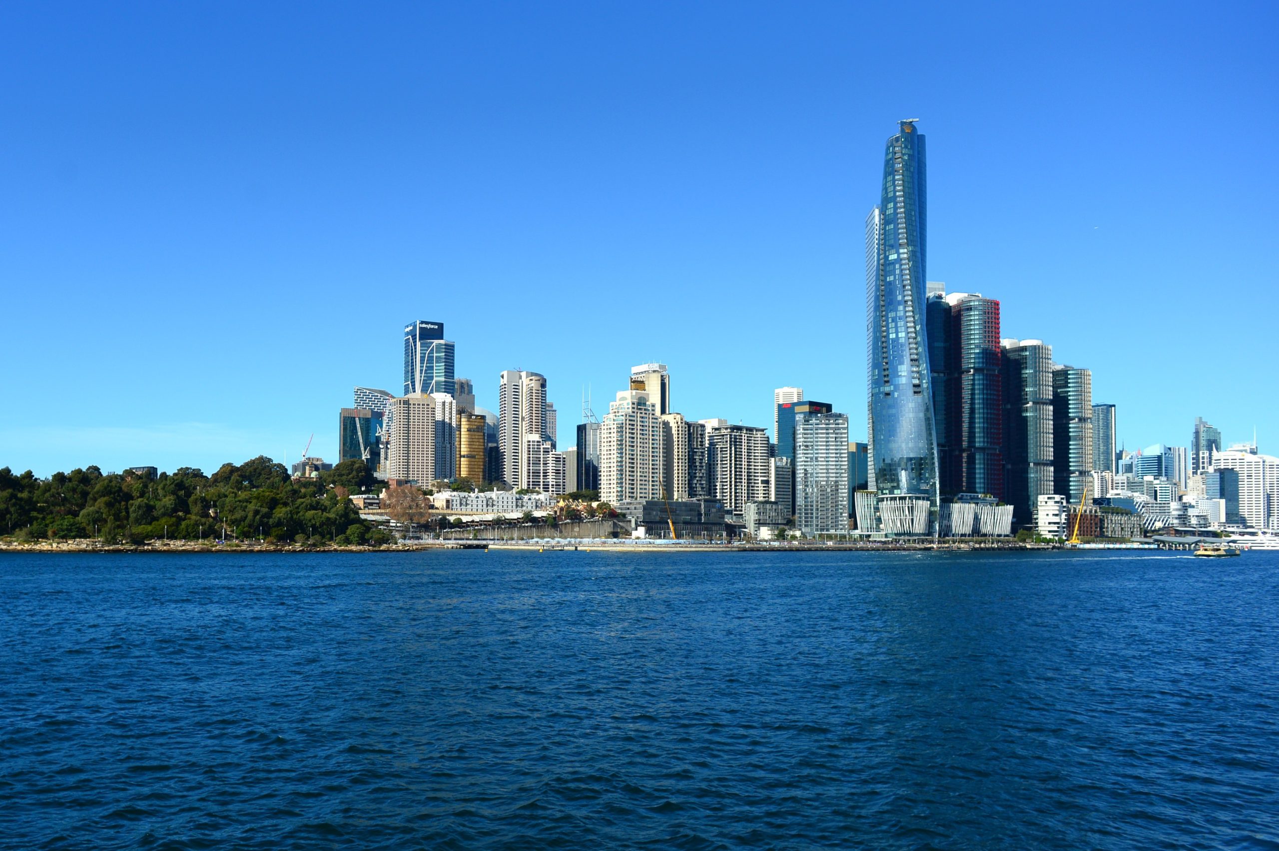
Barangaroo
on Gadigal Country
Wow, so much has changed here in a single generation! From busy wharves to an abandoned cargo port to a world-class business district, Barangaroo is a fascinating place to study the processes of urban change. This site is paired with Pyrmont, just across the harbour and a scenic ferry ride away.
Excursions at this site
Meeting point
Bus Bay at 25 Lime St, Barangaroo 2000
Please check your excursion pack for drop off and pick up directions. If you are having difficulty finding the site, or are significantly delayed, please call the team on 9970 6546 or 0432 549 205.
Risk assessment and site information
Teachers will be provided with a comprehensive Risk Assessment in the Teacher’s Pack prior to the field trip. This contains site information including details of the terrain, accessibility and facilities available. Please contact us with a request if you would like to receive your Risk Assessment earlier.
Bass Point
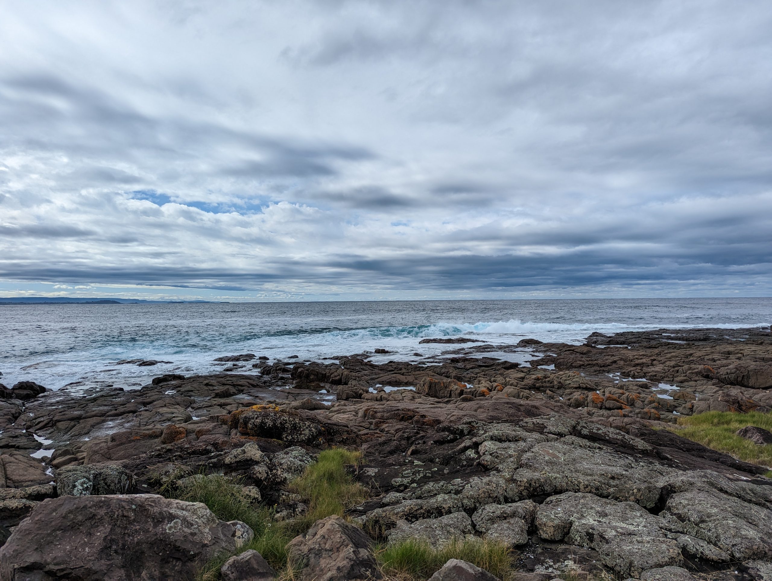
Bass Point
on Wodi Wodi Country
Ideal for schools in southern Sydney or the Illawarra, the rock platforms at Bass Point Nature Reserve abound in marine life. They make an ideal and easily-reached site to study the fascinating creatures living across the tidal zones.
This is a low tide site. Availability will be dependent on the tides, and early booking is recommended.
Excursions at this site
Living World (Stage 4 and Stage 5)
Biology (Modules 3&4 and Independent Research)
International Baccalaureate (ESS and Biology)
Meeting point
Picnic Area near Beaky Bay on Bass Point Tourist Road, Shell Cove 2529
Please check your excursion pack for drop off and pick up directions. If you are having difficulty finding the site, or are significantly delayed, please call the team on 9970 6546 or 0432 549 205.
Risk assessment and site information
Teachers will be provided with a comprehensive Risk Assessment in the Teacher’s Pack prior to the field trip. This contains site information including details of the terrain, accessibility and facilities available. Please contact us with a request if you would like to receive your Risk Assessment earlier.
Botany Bay meeting point
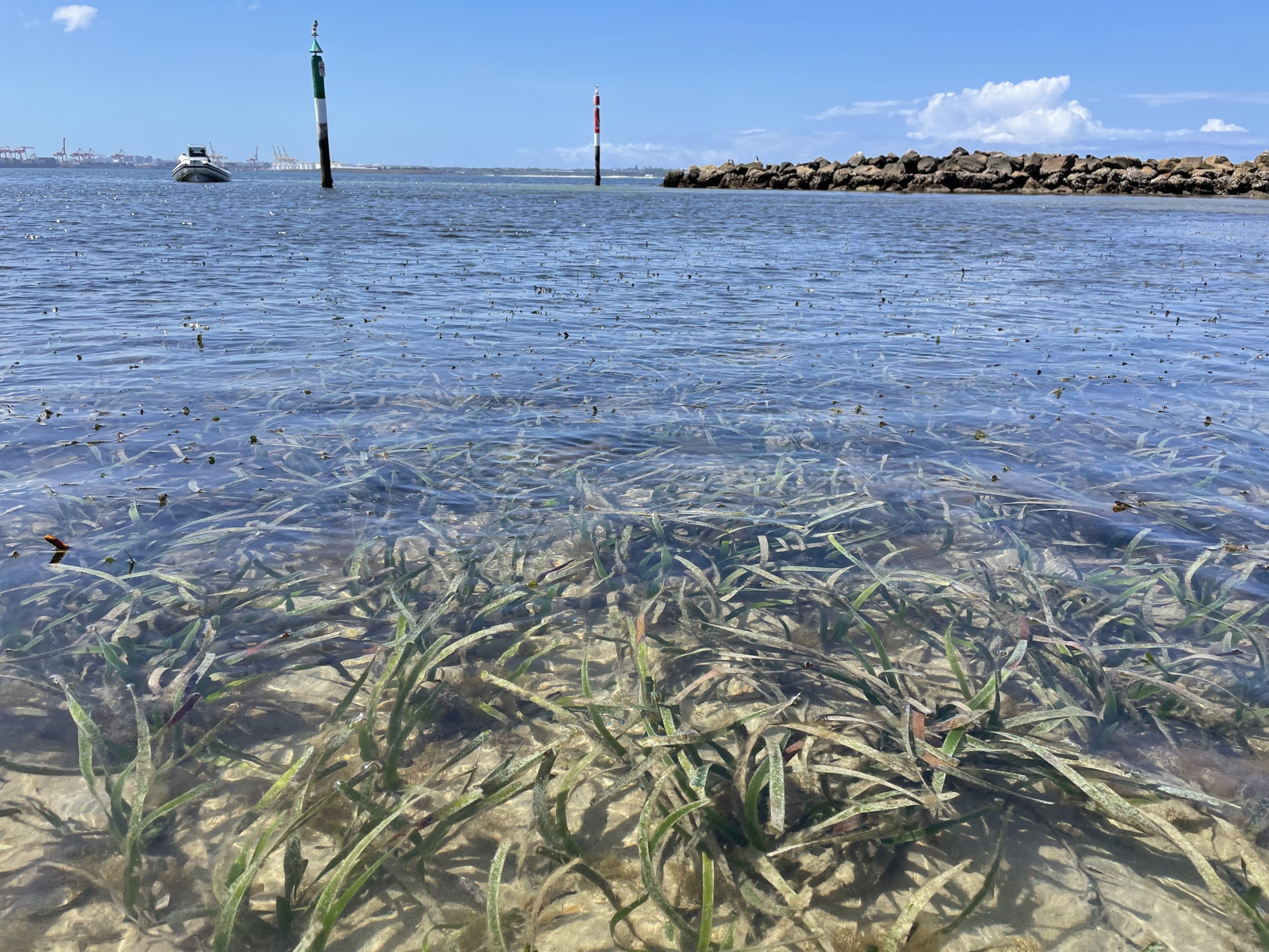
Botany Bay
on Gweagal Country
Who would have thought that such endangered ecosystems would be surviving so close to some of Australia’s largest air and sea ports? Here in the shallow waters of the Botany Bay estuary, the shady mangrove forests and lush seagrass meadows grow close to shore, providing students with a wealth of habitats to study and creatures to encounter. This is a very immersive site with a good likelihood of getting wet or muddy!
This is a low tide site. Availability will be dependent on the tides, and early booking is recommended.
Excursions at this site
Living World (Stage 4 and Stage 5)
Biology (Modules 3&4 and Independent Research)
International Baccalaureate (ESS and Biology)
Sustainable Biomes
Earth’s Natural Systems
Ecosystems & Global Biodiversity
Oceanography (Geography Elective)
Nature Heroes (Early Stage 1)
Homes and Habitats (Stage 1)
Exploring the natural world (Stage 2)
Investigating the natural world (Stage 3)
Meeting point
Bonna Point Reserve, Prince Charles Pde, Kurnell 2231
Please check your excursion pack for drop off and pick up directions. If you are having difficulty finding the site, or are significantly delayed, please call the team on 9970 6546 or 0432 549 205.
Risk assessment and site information
Teachers will be provided with a comprehensive Risk Assessment in the Teacher’s Pack prior to the field trip. This contains site information including details of the terrain, accessibility and facilities available. Please contact us with a request if you would like to receive your Risk Assessment earlier.
Cabramatta meeting point
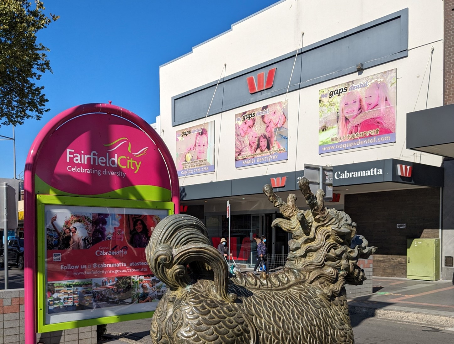
Cabramatta
on Gabrogal Country
The vibrant streets of Cabramatta are a melting-pot of nationalities, with sights, sounds and scents that can transport you far away from Sydney. It’s a great place to explore the influences of cultures in architecture and cuisine, and students are invited to choose from the variety of Vietnamese and other Asian food outlets for their lunch.
Excursions at this site
Meeting point
Arthur West Cabramatta Community Hall, McBurney Rd, Cabramatta 2166
Please check your excursion pack for drop off and pick up directions. If you are having difficulty finding the site, or are significantly delayed, please call the team on 9970 6546 or 0432 549 205.
Risk assessment and site information
Teachers will be provided with a comprehensive Risk Assessment in the Teacher’s Pack prior to the field trip. This contains site information including details of the terrain, accessibility and facilities available. Please contact us with a request if you would like to receive your Risk Assessment earlier.
Camp Coutts meeting point
Camp Coutts
on D’harawal Country
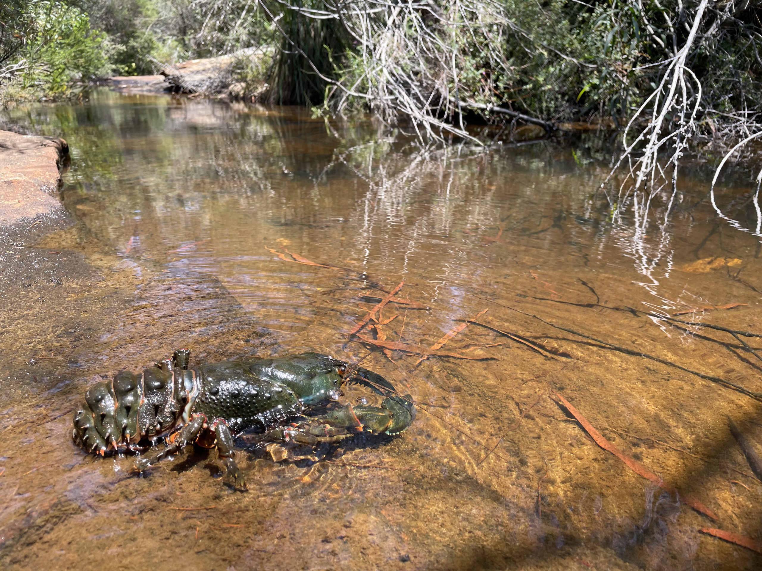
Hidden on the boundary of Heathcote National Park, Camp Coutts is a place of towering eucalypts, sandstone crags and clear running waters. The sandy soils support fascinating plant communities, featuring giant gymea lilies and abundant winter wildflowers, each with intriguing adaptations that help them to survive. Braver students might discover some remarkable residents in the depths of Heathcote Creek.
Excursions at this site
Living World (Stage 4 and Stage 5)
Biology (Modules 3&4)
Earth & Environmental Science (Modules 1&4)
International Baccalaureate (ESS and Biology)
Landscapes & Landforms
Water in the World
Environmental Change & Management
Earth’s Natural Systems
Human-Environment Interactions
Nature Heroes (Early Stage 1)
Homes and Habitats (Stage 1)
Exploring the natural world (Stage 2)
Investigating the natural world (Stage 3)
Meeting point
Camp Coutts Highway turnoff, 2008R Princes Hwy, Waterfall 2233
Please check your excursion pack for drop off and pick up directions. If you are having difficulty finding the site, or are significantly delayed, please call the team on 9970 6546 or 0432 549 205.
Risk assessment and site information
Teachers will be provided with a comprehensive Risk Assessment in the Teacher’s Pack prior to the field trip. This contains site information including details of the terrain, accessibility and facilities available. Please contact us with a request if you would like to receive your Risk Assessment earlier.
Camp Kedron
Camp Kedron
on Garigal Country
Ridges of Hawkesbury Sandstone enclose this secluded valley on Wirreanda Creek. Impacts from human development in this catchment are minimal, unless you look for them, and rare and fascinating creatures are often found in the creeks and surrounding bushland. Examples abound of plants and their communities that have adapted over the millennia to not only survive but thrive in these challenging conditions.
Excursions at this site
Living World (Stage 4 and Stage 5)
Biology (Modules 2&3, Modules 3&4)
Earth & Environmental Science (Modules 1&4)
Landscapes & Landforms
Environmental Change & Management
Earth’s Natural Systems
Nature Heroes (Early Stage 1)
Homes and Habitats (Stage 1)
Exploring the natural world (Stage 2)
Investigating the natural world (Stage 3)
Meeting point
Camp Kedron, Emmaus Road, Ingleside 2101
Please check your excursion pack for drop off and pick up directions. If you are having difficulty finding the site, or are significantly delayed, please call the team on 9970 6546 or 0432 549 205.
Risk assessment and site information
Teachers will be provided with a comprehensive Risk Assessment in the Teacher’s Pack prior to the field trip. This contains site information including details of the terrain, accessibility and facilities available. Please contact us with a request if you would like to receive your Risk Assessment earlier.
Cronulla meeting point
Cronulla finishing point
Cronulla
on Gweagal Country
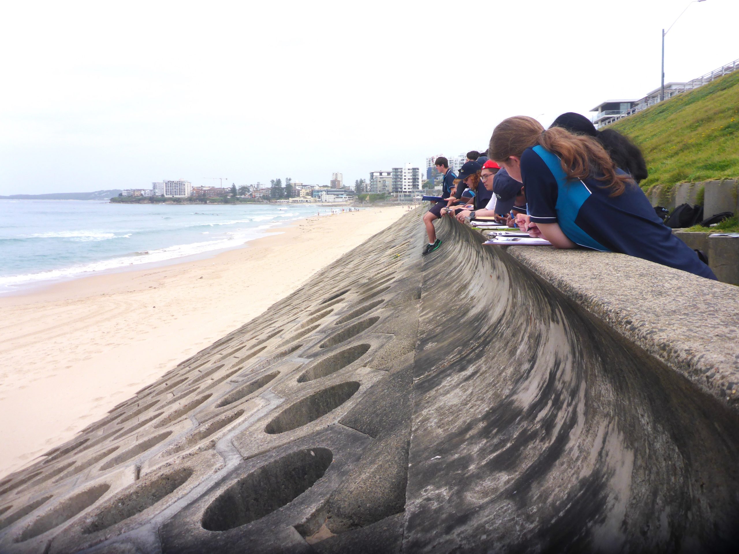
Renowned amongst surfers for their superb swells, the beaches of Cronulla have some of the best active sand dunes in the Sydney region. Coastal erosion and deposition is occurring daily before our eyes! There’s also a great study of failure, and then success, in coastal management down at the controversial Seabee Wall.
Excursions at this site
Meeting point
Wanda SLSC, 2 Marine Esplanade, Cronulla 2230
Please check your excursion pack for drop off and pick up directions. If you are having difficulty finding the site, or are significantly delayed, please call the team on 9970 6546 or 0432 549 205.
Risk assessment and site information
Teachers will be provided with a comprehensive Risk Assessment in the Teacher’s Pack prior to the field trip. This contains site information including details of the terrain, accessibility and facilities available. Please contact us with a request if you would like to receive your Risk Assessment earlier.
Dairy Creek meeting point
Dairy Creek
on Bidjigal Country
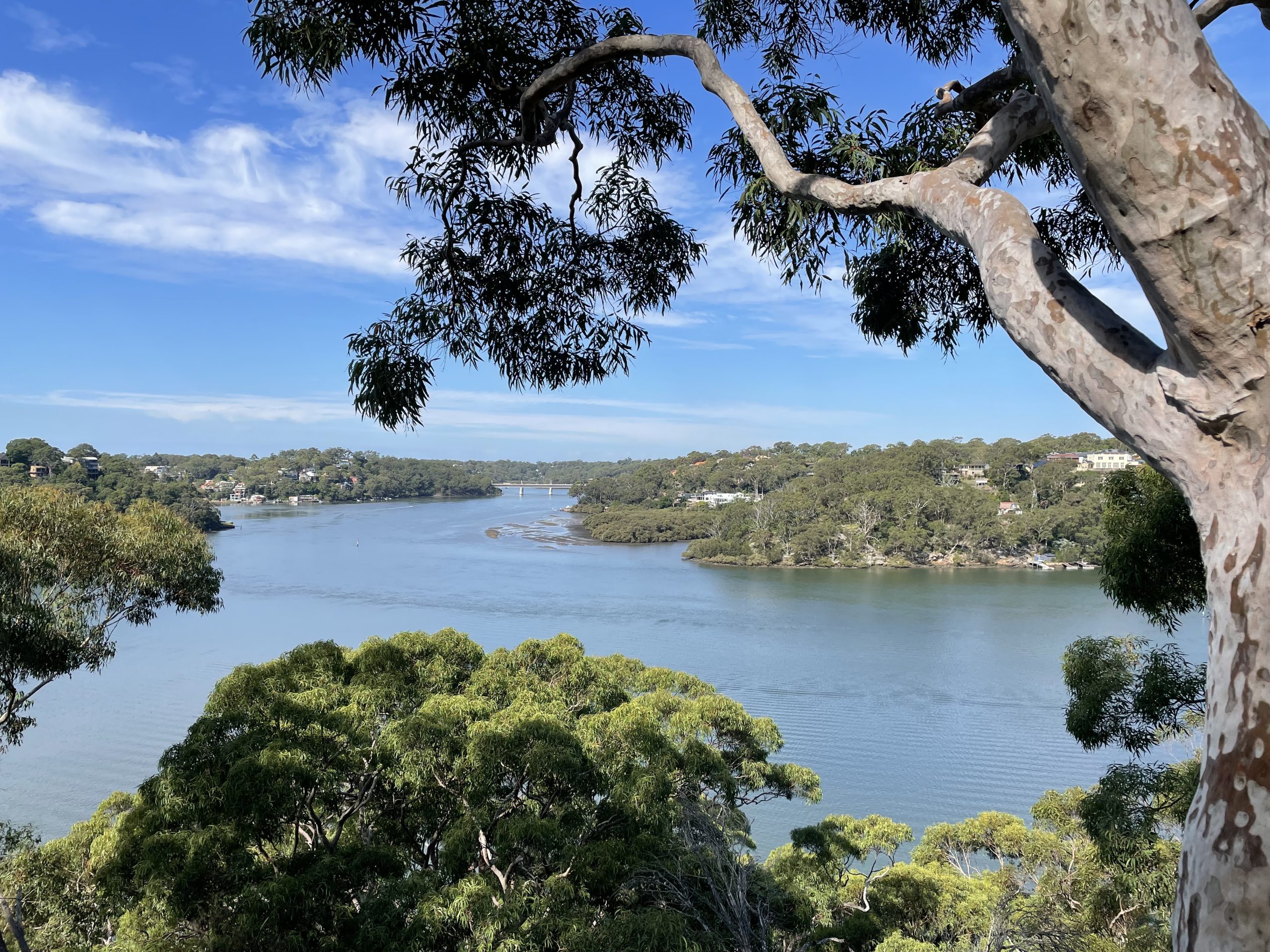
The story of this unassuming little waterway begins in the built-up suburb of Mortdale, where urban runoff and pollutants make the water quality very poor. However, as we follow it through a series of pollutant traps and purifying artificial wetlands, the creek’s health begins to improve. A great place for studying how to right the wrongs of human habitation.
Excursions at this site
Meeting point
3rd Mortdale Scout Hall Headquarters, Cromdale St, Mortdale 2223
Please check your excursion pack for drop off and pick up directions. If you are having difficulty finding the site, or are significantly delayed, please call the team on 9970 6546 or 0432 549 205.
Risk assessment and site information
Teachers will be provided with a comprehensive Risk Assessment in the Teacher’s Pack prior to the field trip. This contains site information including details of the terrain, accessibility and facilities available. Please contact us with a request if you would like to receive your Risk Assessment earlier.
Fisherman's Beach meeting point
Fisherman’s Beach
on Garigal and Gannagal Country
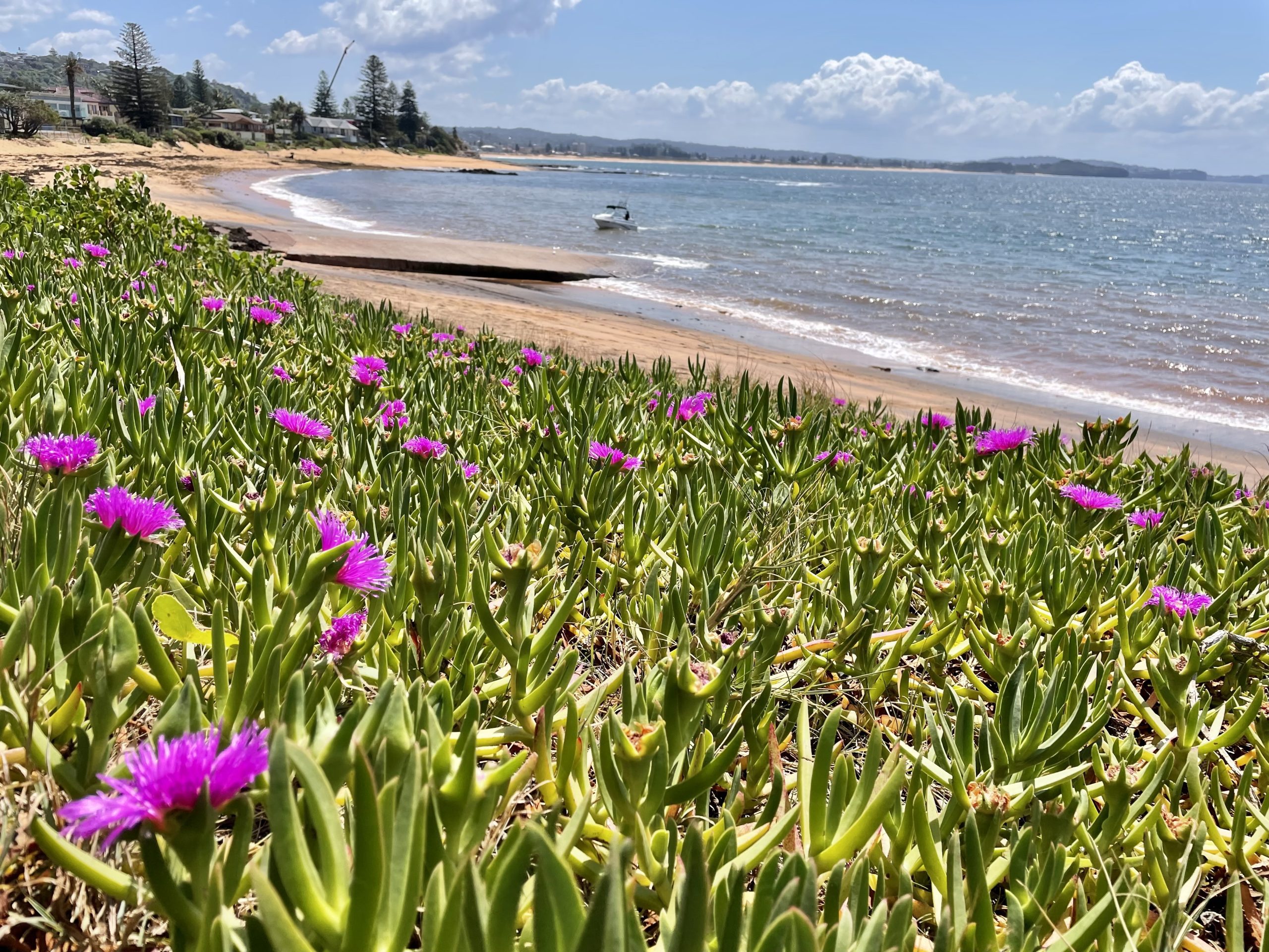
Around Collaroy and Fisherman’s Beach lie an array of features including rutile deposits, fossiliferous sediments, geological fault lines, and evidence of human responses to weather events and climate science. And even better: the rock pools abound in modern descendants of prehistoric arthropods, molluscs and echinoderms. So much to see and study in the one spot!
This is a low tide site. Availability will be dependent on the tides, and early booking is recommended.
Excursions at this site
Earth & Environmental Science (Modules 5-8)
Landscapes & Landforms
Nature Heroes (Early Stage 1)
Homes and Habitats (Stage 1)
Exploring the natural world (Stage 2)
Investigating the natural world (Stage 3)
Meeting point
Warringah Surf Rescue at Fisherman’s Beach, Anzac Ave, Collaroy 2097
OR Collaroy Beach Carpark, Pittwater Rd, Collaroy 2097
Please check your excursion pack for drop off and pick up directions. If you are having difficulty finding the site, or are significantly delayed, please call the team on 9970 6546 or 0432 549 205.
Risk assessment and site information
Teachers will be provided with a comprehensive Risk Assessment in the Teacher’s Pack prior to the field trip. This contains site information including details of the terrain, accessibility and facilities available. Please contact us with a request if you would like to receive your Risk Assessment earlier.
Meeting point
Finishing point
Long Reef and Collaroy coast
on Garigal and Gannagal Country
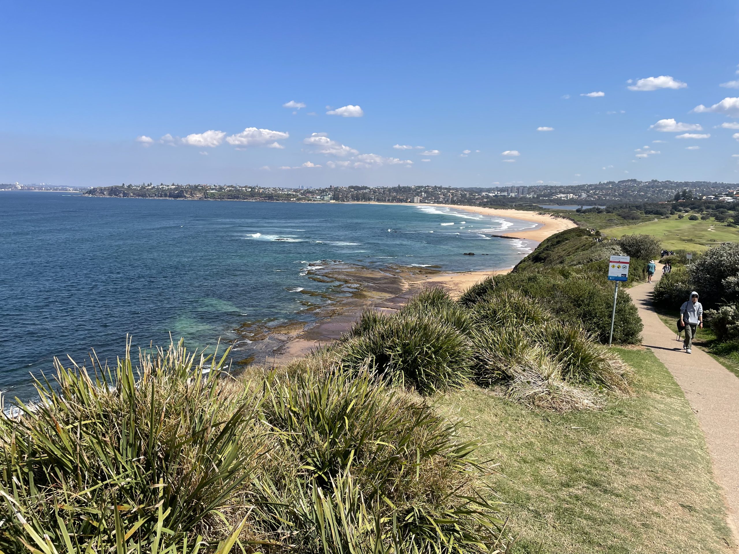
The beaches of Long Reef and Collaroy lie on the same section of coastline, but their historical management has been vastly different. Long Reef offers an opportunity to study a relatively natural sand dune ecosystem, contrasting with the highly-developed shoreline of Collaroy which has needed a variety of strategies to prevent damage from coastal erosion. In between, the soaring Long Reef headland offers students scenic views along the coast and over the waves (and occasionally whales) out to sea.
Excursions at this site
Meeting point
Long Reef SLSC, Pittwater Rd, Collaroy 2097
Please check your excursion pack for drop off and pick up directions. If you are having difficulty finding the site, or are significantly delayed, please call the team on 9970 6546 or 0432 549 205.
Risk assessment and site information
Teachers will be provided with a comprehensive Risk Assessment in the Teacher’s Pack prior to the field trip. This contains site information including details of the terrain, accessibility and facilities available. Please contact us with a request if you would like to receive your Risk Assessment earlier.
Alternative meeting point
Meeting point
Long Reef rock platform
on Garigal and Gannagal Country
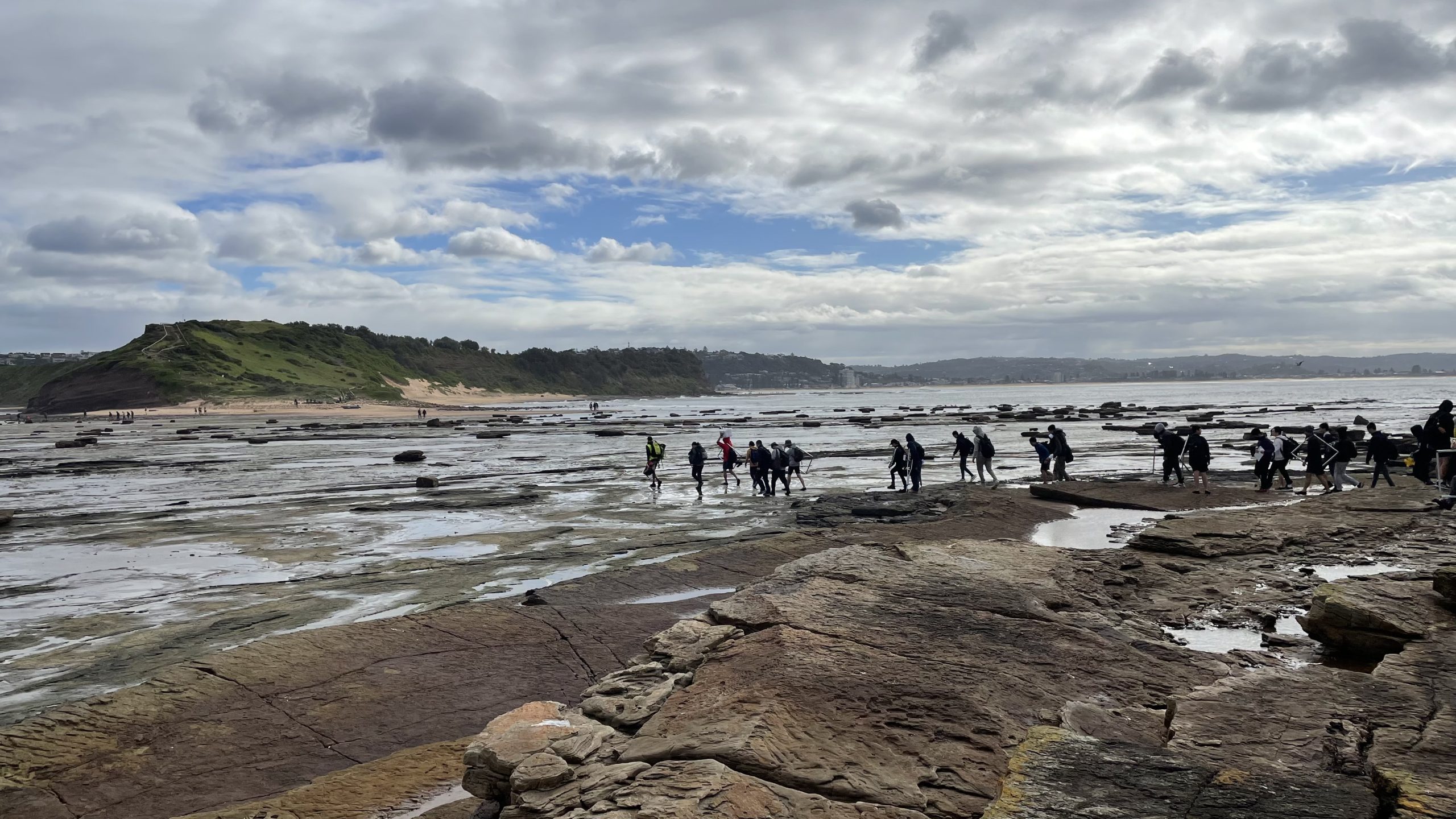
Teachers sometimes remember visiting Long Reef in their own school days, as this Marine Reserve has been used for generations of field trips. One of the largest rock platforms in NSW, Long Reef is remarkable for its diversity of ecological niches and their marine inhabitants. Students can investigate the full range of tidal zones, and searching for creatures to study in the rock pools is always a lottery of surprises.
This is a low tide site. Availability will be dependent on the tides, and early booking is recommended.
Excursions at this site
Living World (Stage 4 and Stage 5)
Biology (Modules 3&4 and Independent Research Projects)
International Baccalaureate (ESS and Biology)
Marine Science
Meeting point
Warringah Surf Rescue at Fisherman’s Beach, Anzac Ave, Collaroy 2097
OR Long Reef SLSC, Pittwater Rd, Collaroy 2097
Please check your excursion pack for drop off and pick up directions. If you are having difficulty finding the site, or are significantly delayed, please call the team on 9970 6546 or 0432 549 205.
Risk assessment and site information
Teachers will be provided with a comprehensive Risk Assessment in the Teacher’s Pack prior to the field trip. This contains site information including details of the terrain, accessibility and facilities available. Please contact us with a request if you would like to receive your Risk Assessment earlier.
Manly Dam
on Garigal Country
Originally constructed as a water supply, the reservoir at Manly Dam has become a wildlife sanctuary and recreation site, hidden in the bush between the suburbs of Allambie and North Balgowlah. It’s the perfect background for studying water quality and human impacts on it, with a variety of influences within the catchment. Crossing the dam wall is not an adventure for the faint-hearted!
Excursions at this site
Living World (Stage 4 and Stage 5)
Water in the World
Meeting point
Manly-Warringah War Memorial Park, King St, Manly Vale 2093
Please check your excursion pack for drop off and pick up directions. If you are having difficulty finding the site, or are significantly delayed, please call the team on 9970 6546 or 0432 549 205.
Risk assessment and site information
Teachers will be provided with a comprehensive Risk Assessment in the Teacher’s Pack prior to the field trip. This contains site information including details of the terrain, accessibility and facilities available. Please contact us with a request if you would like to receive your Risk Assessment earlier.
Meeting point
Finish point
Millers Point to Milsons Point
on Gadigal and Gammeraygal Country
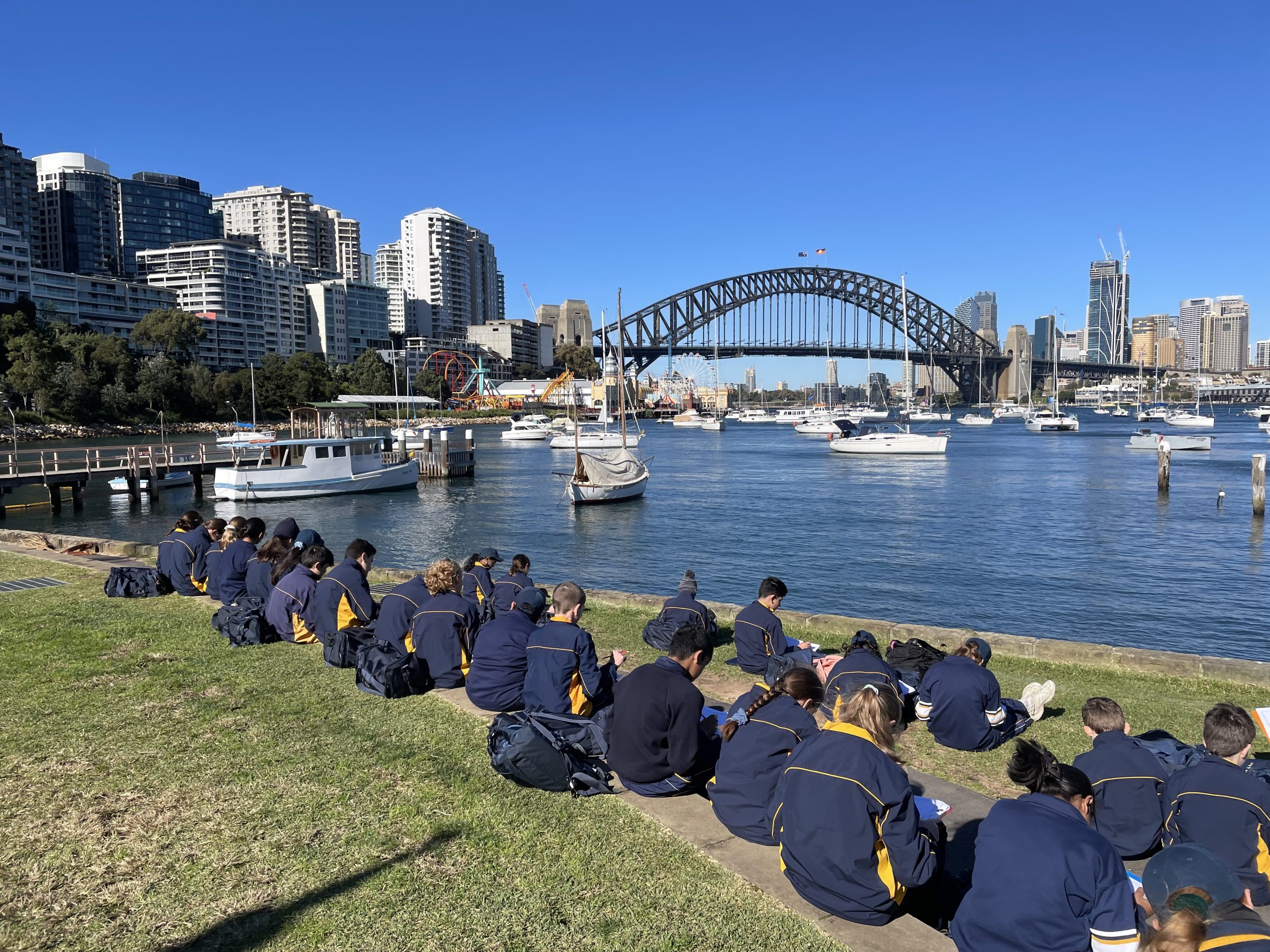
Historic wharves, worker’s terraces and pubs jostle with modern apartments and office space in the inner-city residential enclave of Millers Point. A spectacular walk across Sydney’s mighty Harbour Bridge takes students to the crowded high-rise buildings of Milson’s Point, the charming jungle of Wendy’s Secret Garden, and the still waters of Lavender Bay, bobbing with yachts and the grin of Luna Park. It’s all a great opportunity to reflect on what makes a place feel like home, and how different each person’s needs and values can be.
Excursions at this site
Meeting point
Towns Place, off Hickson Rd, Barangaroo 2000
Please check your excursion pack for drop off and pick up directions. If you are having difficulty finding the site, or are significantly delayed, please call the team on 9970 6546 or 0432 549 205.
Risk assessment and site information
Teachers will be provided with a comprehensive Risk Assessment in the Teacher’s Pack prior to the field trip. This contains site information including details of the terrain, accessibility and facilities available. Please contact us with a request if you would like to receive your Risk Assessment earlier.
Meeting point at Mt Keira Lookout
Alternative meeting point at Girl Guide Camp
Mt Keira
on Wodi Wodi Country
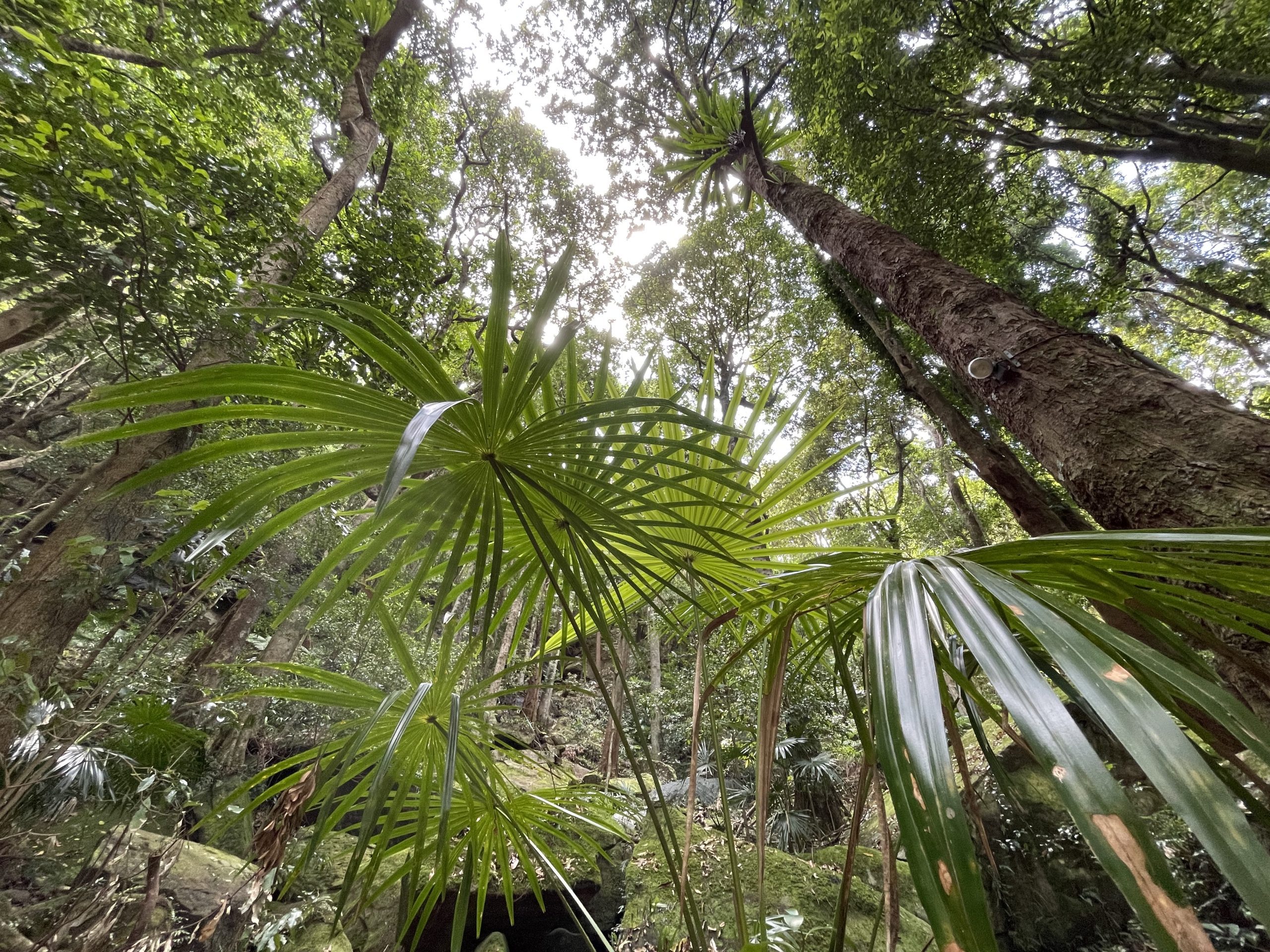
The magnificent Illawarra Escarpment, with its views that go forever over the coastal plain, shelters rare pockets of true rainforest, complete with towering canopy trees, buttressed roots, snaking vines, and ferns and palms in the shaded understorey. It’s easy for students to see how the precipitous topography has such a strong influence on the growing conditions of these unique plant communities.
Excursions at this site
Living World (Stage 4 and Stage 5)
Biology (Modules 3&4)
Earth & Environmental Science (Module 4)
Landscapes & Landforms
Environmental Change & Management
Earth’s Natural Systems
Ecosystems & Global Biodiversity
Nature Heroes (Early Stage 1)
Homes and Habitats (Stage 1)
Exploring the natural world (Stage 2)
Investigating the natural world (Stage 3)
Meeting point
Mt Keira Lookout, Queen Elizabeth Drive, Mt Keira 2500
OR Kum Ba Yah Girl Guide Camp, 333 Mt Keira Rd, Mt Keira 2500
Please check your excursion pack for drop off and pick up directions. If you are having difficulty finding the site, or are significantly delayed, please call the team on 9970 6546 or 0432 549 205.
Risk assessment and site information
Teachers will be provided with a comprehensive Risk Assessment in the Teacher’s Pack prior to the field trip. This contains site information including details of the terrain, accessibility and facilities available. Please contact us with a request if you would like to receive your Risk Assessment earlier.
Meeting point
Narrabeen rock platform
on Garigal and Gannagal Country
At the tidal outflow of Narrabeen Lagoon, this site features a scenic picnic spot overlooking the water, and a more accessible beach and rock platform than our Long Reef site. Up a flight of steps, the lookout above gives picturesque views southwards past the pine trees over the lagoon and beach to Collaroy.
This is a low tide site. Availability will be dependent on the tides, and early booking is recommended.
Excursions at this site
Nature Heroes (Early Stage 1)
Homes and Habitats (Stage 1)
Exploring the natural world (Stage 2)
Investigating the natural world (Stage 3)
Meeting point
Carpark at 1 Narrabeen Park Parade, North Narrabeen 2102
Please check your excursion pack for drop off and pick up directions. If you are having difficulty finding the site, or are significantly delayed, please call the team on 9970 6546 or 0432 549 205.
Risk assessment and site information
Teachers will be provided with a comprehensive Risk Assessment in the Teacher’s Pack prior to the field trip. This contains site information including details of the terrain, accessibility and facilities available. Please contact us with a request if you would like to receive your Risk Assessment earlier.
Meeting point
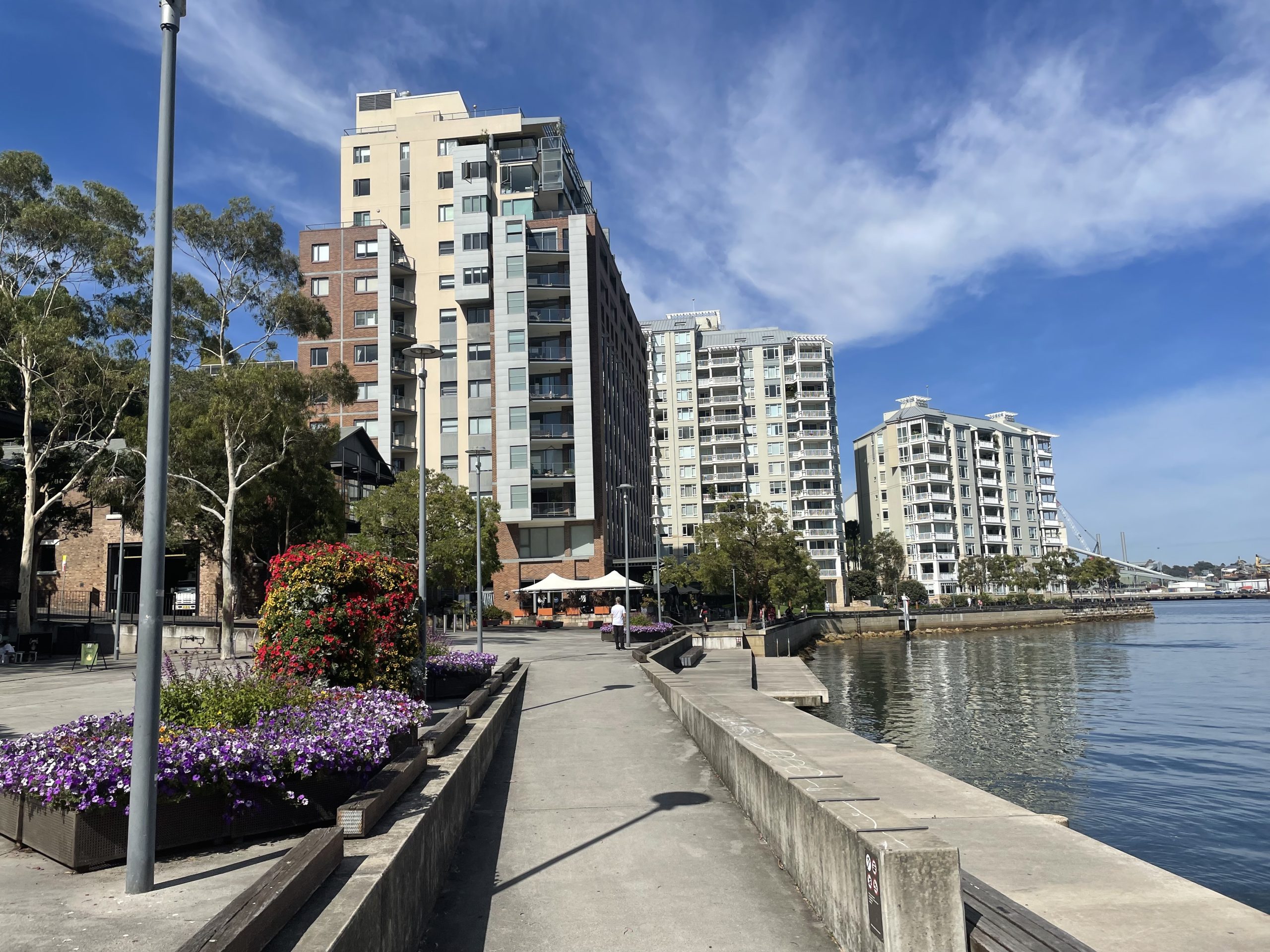
Pyrmont
on Wangal Country
Echoes of Pyrmont’s industrial past can still be seen in the wharves and heritage buildings along the harbour. Students can witness urban change in action, with major renewal projects turning the decaying warehouses and labourers’ slums into classy residences with water views and public open spaces. Paired with Barangaroo, a scenic ferry ride away, Pyrmont makes a fascinating case study in Sydney’s trade economy and providing a solution to urban sprawl on the city’s fringes.
Excursions at this site
Meeting point
Pirrama Park, end of Harris St, Pyrmont 2009
Please check your excursion pack for drop off and pick up directions. If you are having difficulty finding the site, or are significantly delayed, please call the team on 9970 6546 or 0432 549 205.
Risk assessment and site information
Teachers will be provided with a comprehensive Risk Assessment in the Teacher’s Pack prior to the field trip. This contains site information including details of the terrain, accessibility and facilities available. Please contact us with a request if you would like to receive your Risk Assessment earlier.
Meeting point

Ultimo and Chippendale
on Gadigal Country
Did you know that education is one of Australia’s most lucrative exports? Here in the shadow of the brutalist UTS Tower, classes can explore the vibrant student-based economy growing up around the abandoned brewery site and goods line. The colourful Spice Alley delights the senses with Asian street food at lunchtime.
Excursions at this site
Meeting point
Central Station Forecourt Park, via Railway Colonnade Dr, Haymarket NSW 2000
Please check your excursion pack for drop off and pick up directions. If you are having difficulty finding the site, or are significantly delayed, please call the team on 9970 6546 or 0432 549 205.
Risk assessment and site information
Teachers will be provided with a comprehensive Risk Assessment in the Teacher’s Pack prior to the field trip. This contains site information including details of the terrain, accessibility and facilities available. Please contact us with a request if you would like to receive your Risk Assessment earlier.

